This region’s topography is not very different from the Biobío as it maintains the four traditional relief forms from the coastal zone up to the Andes Ranges.
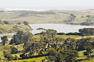
-Littoral plains: they have a scarce development, except at the Imperial river mouth and the Budi lake were are quite wide reaching up to 25 km There are also numerous brooks that generate groups of hills reaching up to 200 masl.
-Coastal ranges: at the northern part of the region, this relief form takes the name of Nahuelbuta ranges. It is characterized by being massif and reaching a maximum height at the Alto Nahuelbuta hill (1.655 masl). The height decreases at the southern part disappearing at the Imperial river mouth. This topography is replaced by undulated shapes reaching only 300 masl.
-Intermediate depression: it becomes slightly more undulated as it looses the flat feature that had at the previous regions. At the northern sector is narrower due to the action exerted by the Nahuelbuta Ranges. Thence becomes wider and reaches its maximum width between the comunas (counties) of Temuco and Gorbea. At the Lastarria locale is obstructed abruptly by the Afquintúe mountain range but then appears weakly once again at Loncoche.
-The Andes Ranges: it achieves heights between the 300 and 850 masl. The pre Andean zone has a sedimentary origin. Although the average height decreases, the Andean mountain range preserves its massif feature. The highest summit is the Lanín volcano (3.747 masl), located at the region´s southern part, at the boundary with Argentina, and is followed by the Llaima volcano (3.125 masl.), the Cónico hill (3.060 masl.), the Lonquimay volcano (2.865 masl.), the Villarrica volcano (2.847 masl.), the Tolhuaca volcano (2.806 masl.) and the Quetrupillán volcano (2.360 masl.).