This region has the four typical forms of relief, though there is a notorious decrease of heights at the Andean zone and the intermediate depression moves slowly westwards, crushing with the Coastal ranges.
– Littoral plains: only reach a considerable development at the mouth of the Maullin river and at the interior coast of the Isla Grande of Chiloe.
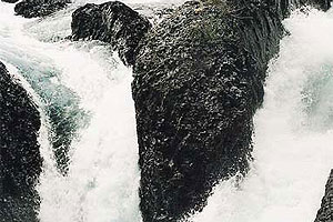
– The Coastal Ranges: it is compound by metamorphic and in some places by granite rocks. They appear at two mountainous regions called Pelada and the Sarao ranges. Afterwards, at the Isla Grande of Chiloe, originates northwards the Piuchen and southwards the Pirulil ranges.
– Intermediate depression: it has no interruptions until it disappears completely at the Relocavi estuary. From the Bueno and Pilmaiquen rivers, it is thrown out of balance up to 100 meters. As from the Rahue river, the glacial form inherited from the great marshy masses becomes more notorious. It sinks Southwards Puerto Montt, so that the sea (that has penetrated by the Chacao channel) overflows it almost completely, being secluded to only some groups of islands and to the western fringe of the Isla Grande of Chiloe.
– The Andes Ranges: outstands the decrease of its heights (the main summits reach an average of 2.500 masl) and is mainly and particularly volcanic. Amongst its greatest elevations stand out the Tronador hill (3.491 masl), the Osorno volcano (2.404masl), the Michimahuida volcano (2.404 masl), the Calbuco volcano (2003) masl) and the Antillanca volcano (1.990 masl).
Hydrography
This sector characterizes for having a great amount of water resources due to glaciers, rain and relief. Amongst the most important rivers are:
– Rio Bueno: its basin has a15.124 km2 surface which makes it the fifth biggest in the country. It is originated at the western extreme of the Ranco Lake (Region of the Rios) and flows onto the Pacific Ocean. It has a rainy system except when it crosses the high ranges where it has a snowy feature. Its main effluents are the Pilmaiquen and Rahue rivers.
– Petrohue River: is born at the Todos Los Santos Lake and drains a 3.036 km2 basin. Their regimes are rainy and its waters at the beginning are calm though afterwards they become a strong fast-flowing river. After covering 38 kms, it mouths at the Reloncavi estuary forming a wide delta.
– Maullin River: is born at the southwestern seashore of the Llanquihue Lake and is the second most extense lake of the country (878 km). It has a rainy regime and drains a 4.738 km2 basin. It mouthes at the Pacific ocean after covering near 65 km.
– Puelo River: it drains an 8.830 km2 surface. At its superior course, receives the waters of the Las Rocas, Verde, Totoral and Azul lakes, as well as of the Ventisquero river and the Puelo river (Argentina). In its mid part, it takes the Manso river waters, its main effluent, and finally mouths at the Reloncavi estuary (at the locale of Puelo).
– Yelcho River: is originated at the Yelcho lake western extreme and after covering 40 km mouths at the Corcovado Gulf, southwards Chaiten.
Likewise, it must be included a small part of the Palena river basin developed at this region. This is born at the Palena Lake (with a 53 km2 surface in our country) and after covering Argentinean territory inroads Chile again with an estimated 100 m3/sec average water flow.
Besides, there is a series of rivers at the province of Palena that are very fast-flowing though with a scarce development. They are the Vodudahue, Reñihue, Corcovado and Tictoc rivers.
The following lakes also stand out:
– Llanquihue Lake: is the second largest in Chile, after the General Carrera Lake. Is located at 20 km northwards Puerto Montt, it has 878 km2 and its main effluents are the Pescado, Blanco and Tepu rivers. Lengthwise along its seashore, there are several cities such as Puerto Varas, Puerto Octay, Frutillar and Llanquihue. Besides the La cascada and Ensenada beach resorts.
– Rupanco Lake: is located at 40 km from Puerto Octay. It has a 230 km2 surface and a glacial origin. Within it stands out Las Cabras and Los Ciervos islands. Its waters are used for nautical sports and salmon angling.
– Todos Los Santos Lakes: it has also a glacial origin and is located at the Vicente Perez Rosales National Park. It has a 178, 5 km2 surface and 337 meters deepness. Its main effluents are the Peulla and Negro rivers. It mouthes at the Petrohue location given birth to the likewise named river. It has dense vegetation made of ulmos, olivillos and coigües and some marine species such as trout and salmons.


 Muere Evita