The Region of the Lagos is a very humid area where precipitations extend throughout the whole year. This is due to the influence of latitude and altitude. Five kinds of climate are distinguished:
– Rainy template climate with land-locked influence: it stretches by the intermediate depression’s western part up to the Chacao’s channel eastern part, penetrating, besides, in the western zone of the Isla Grande of Chiloe. Precipitations vary from 1.800 and 2.500 mm annually and average temperatures oscillate between the 9 and 12° C.
– Rainy warm template climate with summer precipitations decrease: it develops at spaces at the Coastal Ranges western slope. Its precipitations vary between the 1.200 and 1.300 mm and the annual average temperatures oscillate between the 10 and 12°c. Nevertheless, in summer, the monthly averages rise to 16 or 17°C.
– Rainy warm template climate: it stretches from the intermediate depression to Chiloe’s interior sea. Also, it appears at this island’s western coastal fringe and at the Guafo island. Rains are high and last the whole year, recording a third of the annual total in summer. The Puerto Montt city has an annual average temperature of 11,2°C and its rainfall reaches 1.840 mm.
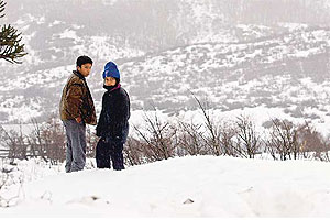
– Rainy cold template climate or mountainous: it happens at the Andes Ranges above the 500 masl. The rainfall increases and the annual averages oscillate between the 2.500 and the 4.000 mm. which falls as snow during the winter months. The annual average temperature vary between the 6 and 9°C.
– Ice climate due to height: it develops above the 1.800 masl at the northern part and 1.200 at the Andean zone southern part. Precipitations surpass the annual 3.000 masl and the minimum temperatures remain below cero throughout most part of the year.


 Muere Evita